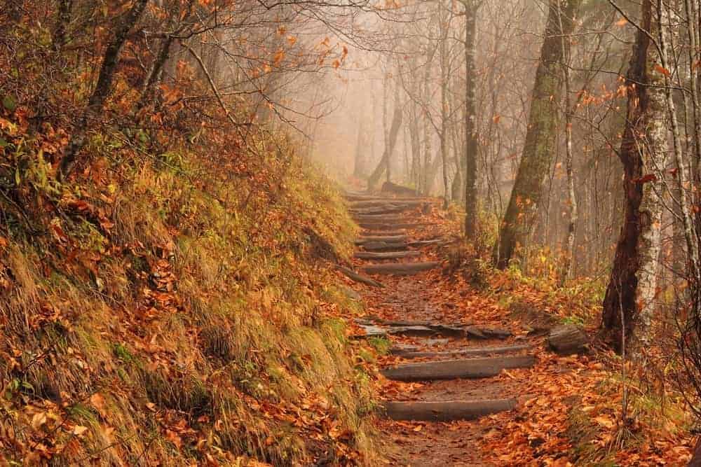
Top 5 Fall Smoky Mountain Hiking Trails in Wears Valley
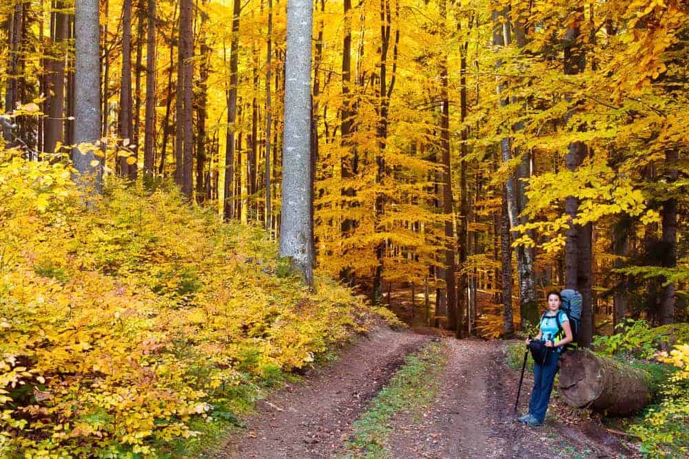
When it comes to fall in the Smokies, the question on everyone’s mind is always about where they can find the best view of the Smoky Mountains fall foliage. Now, if you have ever visited the Smoky Mountains this time of year, then you already know about all the great scenic overlooks and attractions that offer incredible views of the fall leaves. However, one place you may not have visited is the peaceful Wears Valley.
Wears Valley is known to be one of the most relaxing and scenic areas in the Smoky Mountains. Not only can visitors find a ton of great tasting restaurants in Wears Valley, but it is also where guests can find some of the most picturesque and relaxing hiking trails.
Don’t believe us? Be sure to check out our top five fall Smoky Mountain hiking trails in Wears Valley below!
 1. Metcalf Bottoms

The Metcalf Bottoms hiking trail is a short hike that takes visitors from the Metcalf Bottoms picnic area to the Little Greenbrier School. Considered to be one of the easiest fall Smoky Mountain hiking trails in Wears Valley, Metcalf Bottoms is perfect for beginner hikers, or families traveling with small children.
When you are here, don’t forget to sit down and relax while you and your family enjoy a delicious picnic at the Metcalf Bottoms picnic area found at the trailhead.
Trail Summary:
- Location:
- 1.2 miles round trip
- Easy difficulty rating
2. Laurel Falls
Laurel Falls is by far one of the most popular Smoky Mountain hiking trails in Wears Valley. During the hike, visitors will experience not only the beautiful Smoky Mountain fall foliage, but they will also come across a roaring waterfall, perfect for snapping a souvenir photo or enjoying a light picnic. Early morning hikes are ideal to get the best photo of the waterfall.
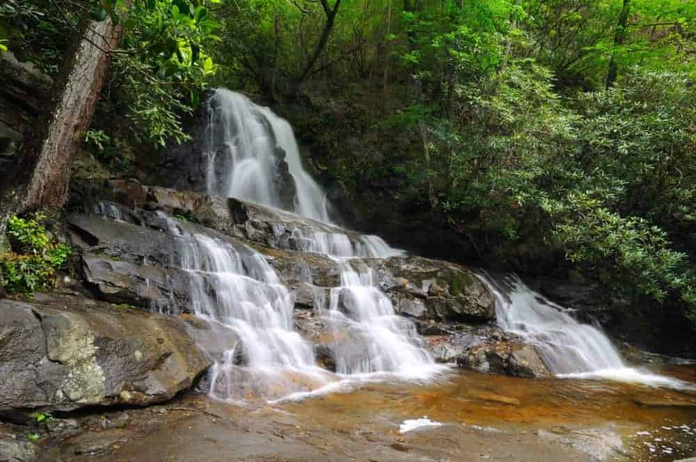 To reach the trailhead of this fall Smoky Mountain hiking trail in Wears Valley, visitors won’t have to drive far. This trail begins just over 13 miles away from the Townsend “Y” intersection.
Trail Summary:
- Location: Little River Road
- 2.3 miles round trip
- Elevation gain of 314 feet
- Easy difficulty rating
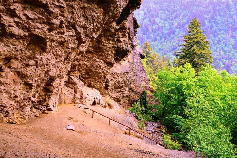
3. The Sinks
The Sinks is the official name for the turbulent waterfall that is found along the Meigs Creek Trail. A popular summer swimming spot for visitors in the summer, this hiking trail also offers some of the most incredible fall colors in the Smoky Mountains.
For the more adventurous hikers looking to experience even more of the fall beauty along this fall Smoky Mountain hiking trail in Wears Valley, you can continue on the Meigs Creek Trail past The Sinks to the Upper Meigs Falls. Though not as ideal for swimming a The Sinks, the Upper Meigs Falls is a great place to spot some of the areas most famous amphibians, the salamanders.
 Trail Summary:
- Location:
- 3 miles round trip
- Elevation gain of 752
- Moderate difficulty rating
4. Ace Gap
Ace Gap is a quiet and secluded Smoky Mountain hiking trail located near Wears Valley. At 11 miles round trip, this trail is considered to be moderate in difficulty. However, the beautiful fall foliage and peaceful sounds of nature make this one of our favorite fall hikes in the Smokies.
Trail Summary:
- Location: Townsend
- 11 miles round trip
- Elevation gain of 400 feet
- Moderate difficulty rating
5. West Prong Trail
Located in the Tremont area of the Great Smoky Mountains National Park, the West Prong Trail is just over 5 miles round trip. Visitors to this scenic fall Smoky Mountain hiking trail should expect to experience a total elevation gain of 1,375 feet, at roughly 500 feet a mile.
 Thanks to its smooth path, this course is rated as an easy-moderate fall Smoky Mountain hike, so visitors from most experience levels are sure to have a blast here.
To get to the trailhead for the West Prong Trail, visitors should head west on Laurel Creek Road from the Townsend “Y” intersection. The trailhead is roughly two-tenths of a mile from there, just before you reach the Institute at Tremont.
Trail Summary:
- Location: Tremont
- 5.4 miles round trip
- Elevation gain of 1,375 feet
- Easy-moderate difficulty
Be sure to click here to learn more about the Great Smoky Mountains National Park and start planning your visit today!